A tropical disturbance strengthening in the western Caribbean Sea is expected to reach near hurricane strength by Tuesday night, according to weather forecasts.

This developing system, named Potential Tropical Storm Nine, will likely become the eighth named storm of the season, officially named Helene, and is forecasted to evolve into a tropical storm by Tuesday morning. The National Hurricane Center (NHC) has predicted that tropical storm conditions will affect areas of western Cuba and the northeastern coast of the Yucatan Peninsula. These regions could experience heavy rains, flooding, and possible mudslides as the storm progresses.
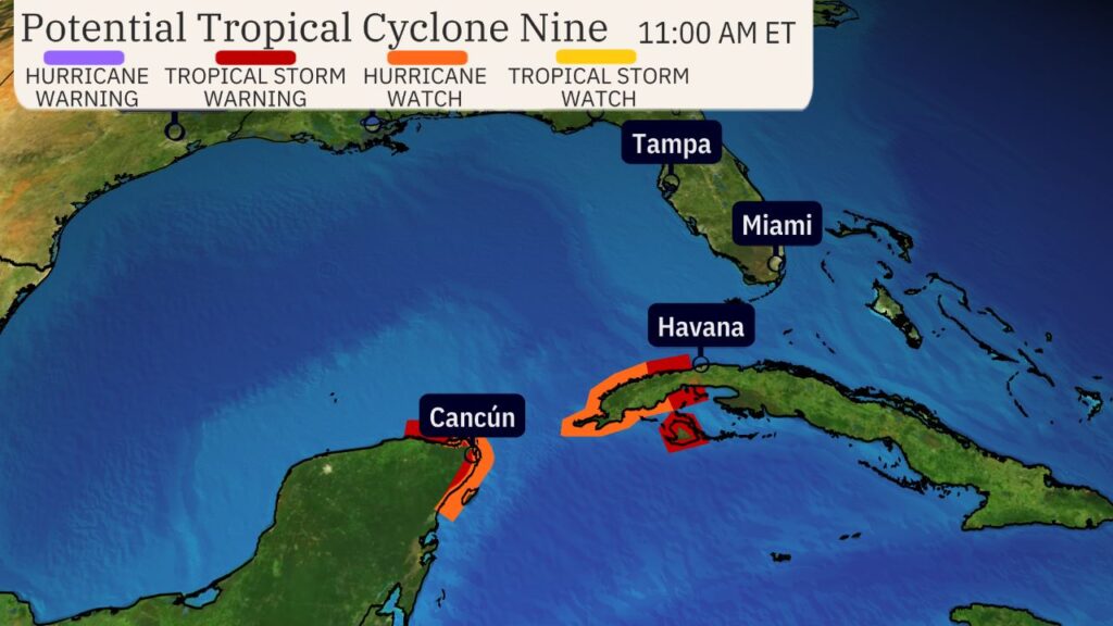
Though the storm has not yet developed a well-defined center, experts caution that it poses a substantial threat to Florida. According to meteorological reports, Florida could face hurricane conditions by Thursday, with early impacts expected by Wednesday night, particularly in the Tampa Bay Area.
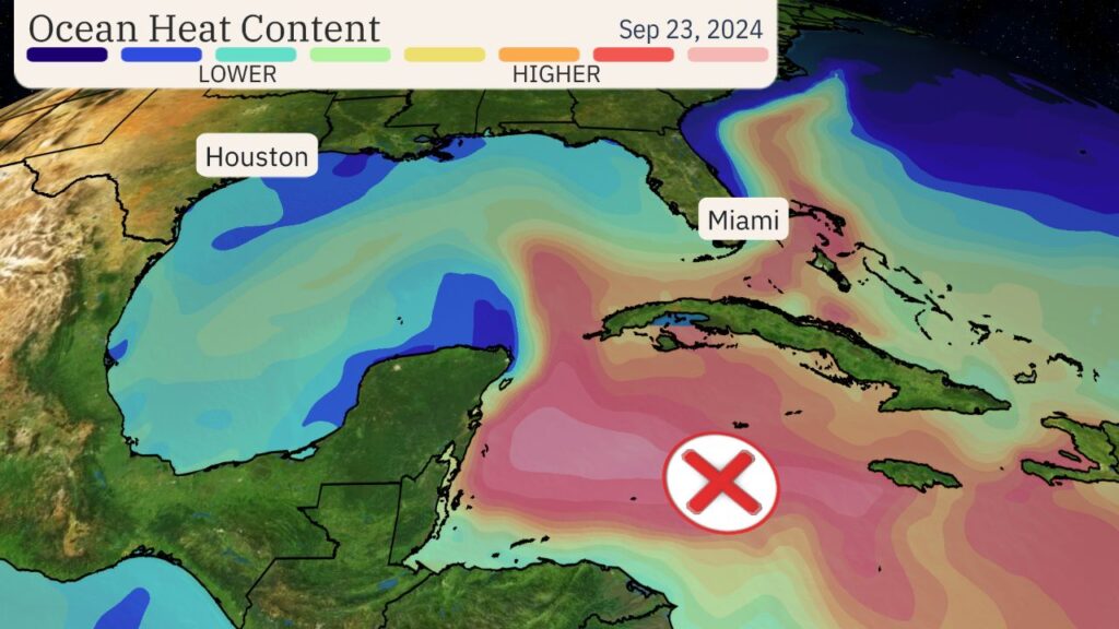
Weather specialists have advised residents of the Florida Panhandle and Big Bend region to be on high alert and prepared for potential hurricane impacts. The system is expected to intensify further as it moves northward into the eastern Gulf of Mexico, with the possibility of becoming a major hurricane before making landfall on the northeastern Gulf Coast by Thursday.

Forecasts indicate the likelihood of life-threatening storm surges and hurricane-force winds in areas that include the northern and northeastern Gulf Coast, including the Florida Panhandle and portions of the state’s west coast. While it remains too early to determine the exact track and strength of the storm, residents in these regions are encouraged to follow updates closely and have a hurricane preparedness plan in place.
This storm may become the strongest to make landfall in the United States so far this hurricane season, with significant potential for damaging winds, flooding, and storm surge.
Regardless of its precise path, the storm will bring heavy rainfall to parts of Central America over the next few days, adding to the risks of flooding in vulnerable regions. Storm watches and warnings are expected to be issued for parts of the northwestern Caribbean, Yucatan Peninsula, and western Cuba shortly.
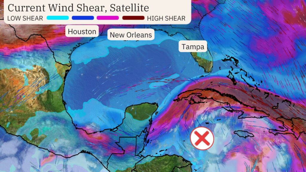
Meteorologists note that the storm’s track could still shift, depending on where a clear center forms. If it develops farther east or west than expected, the storm’s projected path could move accordingly, affecting different parts of the coastline.
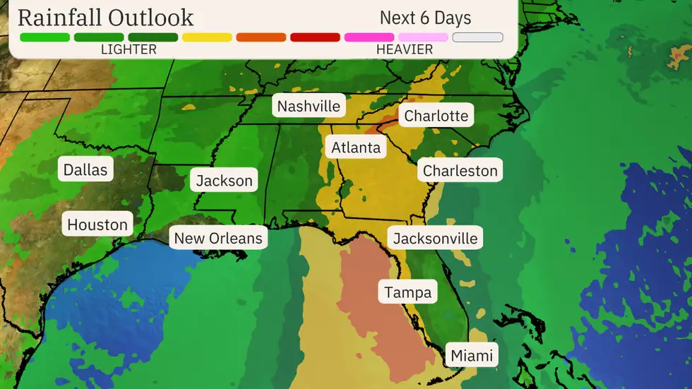
Florida’s Panhandle and Big Bend areas, in particular, should remain vigilant, as they are most likely to experience the brunt of the storm. While the system is predicted to move quickly, offering some relief in terms of rainfall duration, there is enough time for it to become a strong hurricane before landfall.
As the storm continues to strengthen, it is crucial for residents along the Gulf Coast, from New Orleans to Key West, to keep a close eye on its progress.